Labor Day Weekend Camping (the End and the Beginning)

As a child, Labor Day weekend gave me the feeling of being pulled between two worlds.  I wanted to soak up the final few hours of summer and freedom, and yet the inevitability of school and backpacks and homework loomed, but with it the hope of a new beginning.  Labor Day weekend meant enjoying the final moments of one season while preparing for the start of the next.  

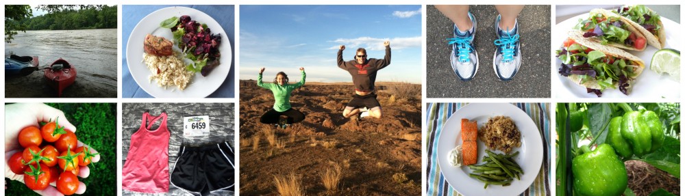
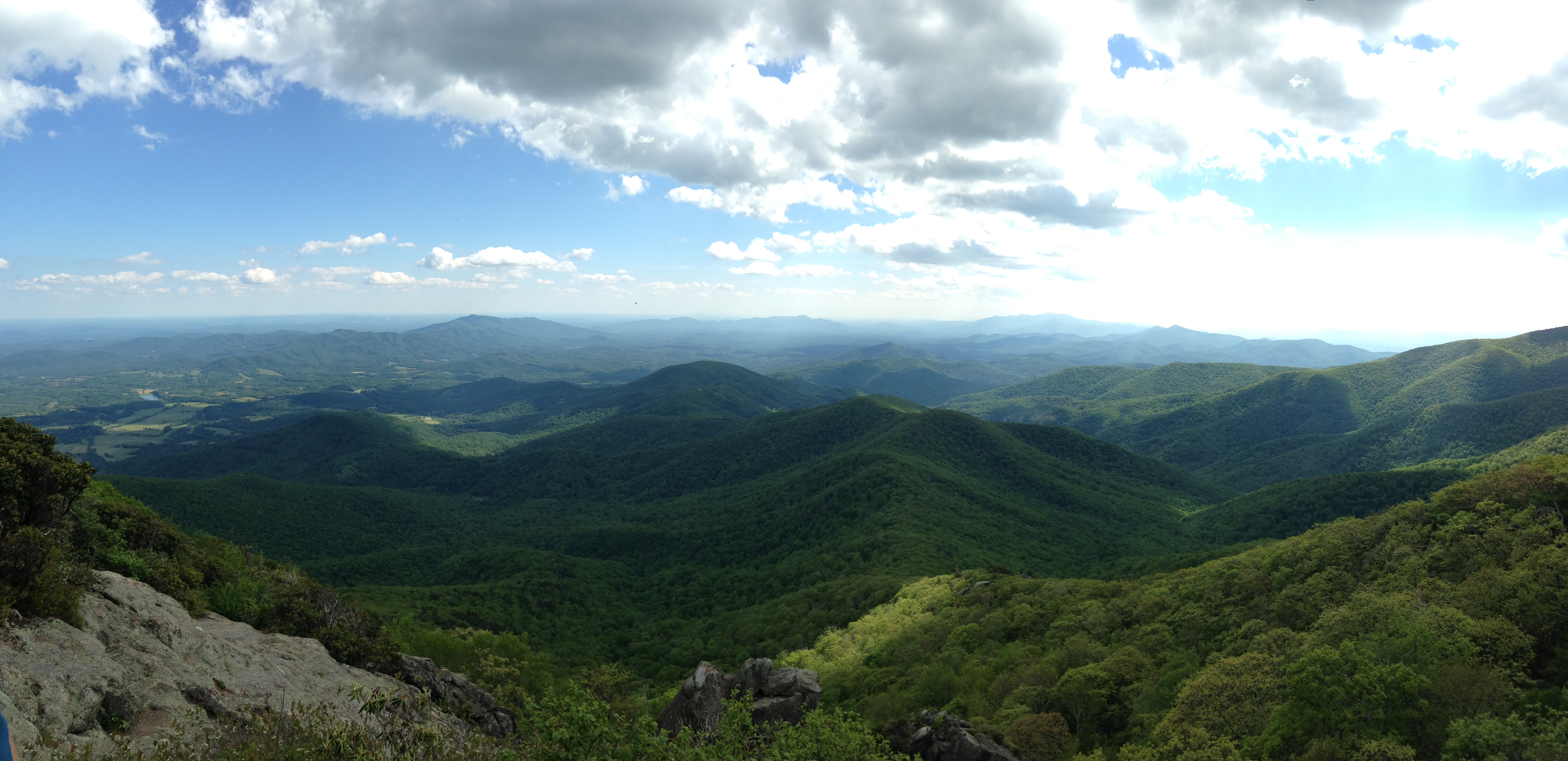
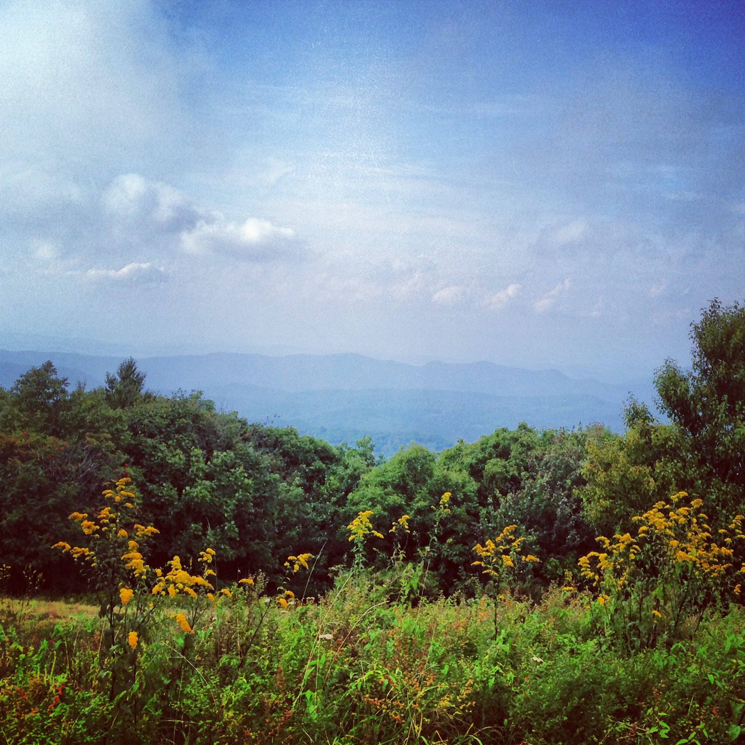
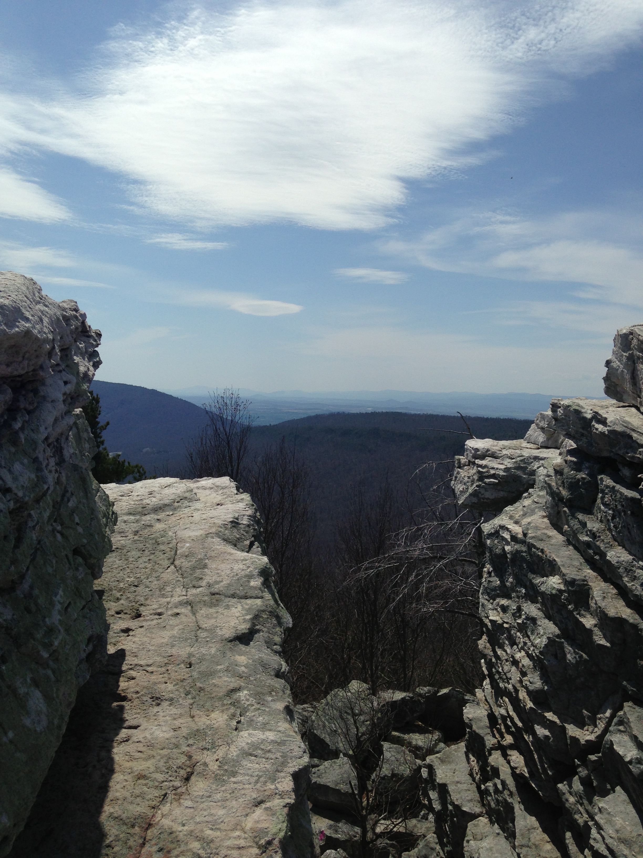
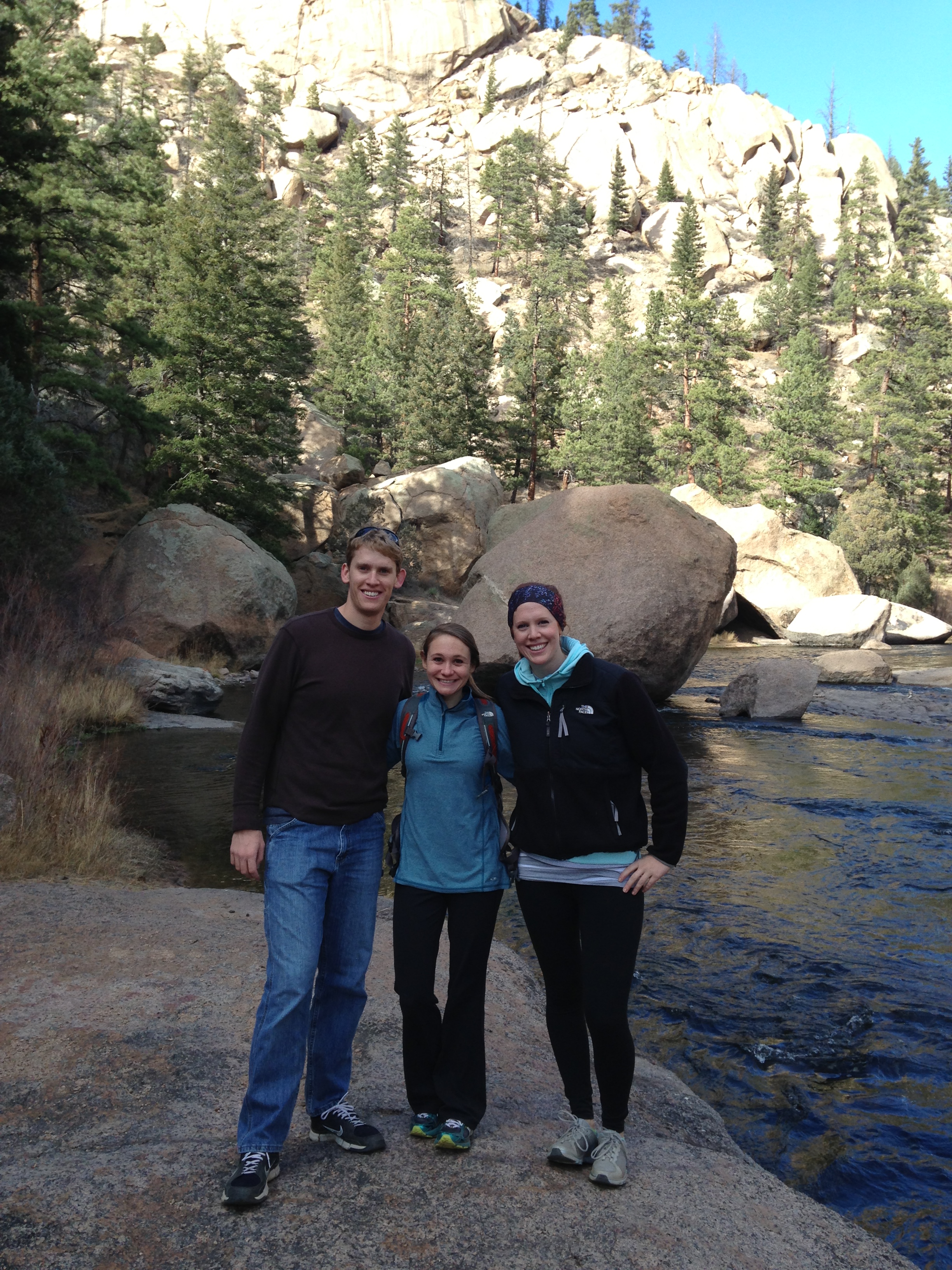
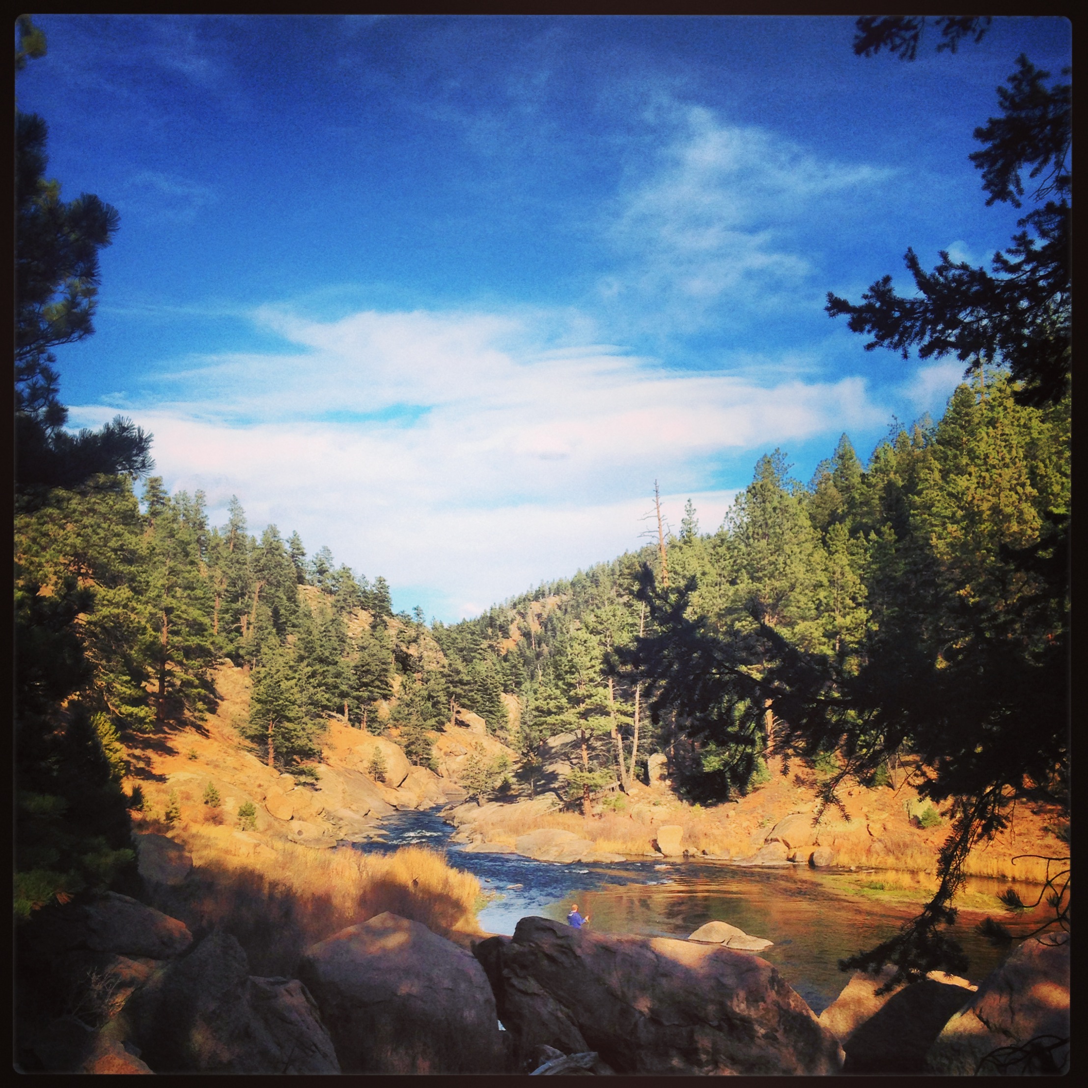
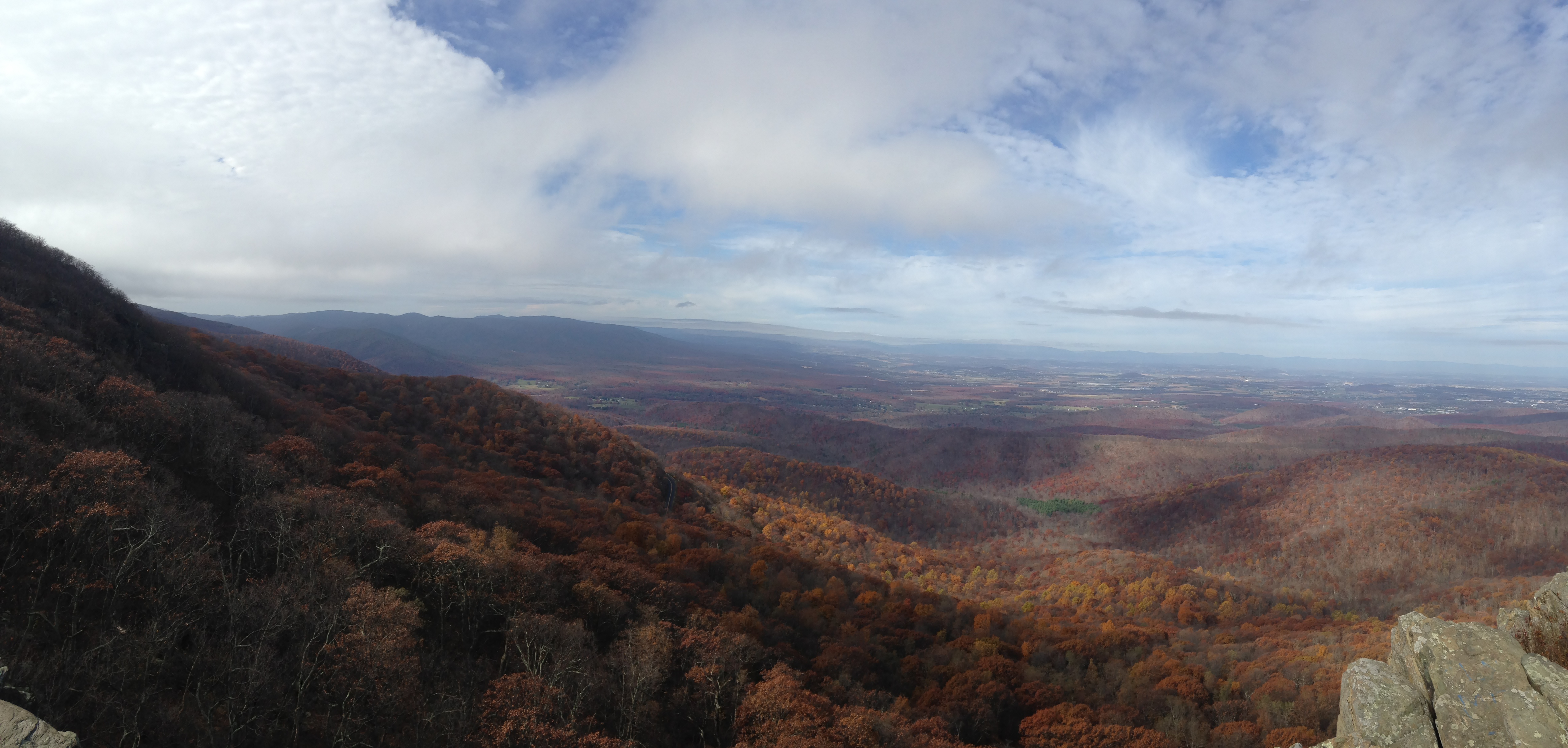
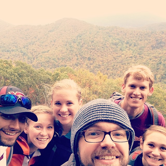
This Labor Day weekend Andrew and I joined our friends Elliott and Lauren for two days of roughing it in the woods: camping, hiking, peeing behind trees.  We drove into the mountains Friday evening and set up camp in the dark.  Saturday morning, after filling up on oatmeal and French press coffee, we began the first of two hikes planned for the day: Mount Pleasant.  Andrew and I had hiked it on a previous camping weekend, and the views are stunning.  On a clear day, this is what you’ll see:

IMG_5719

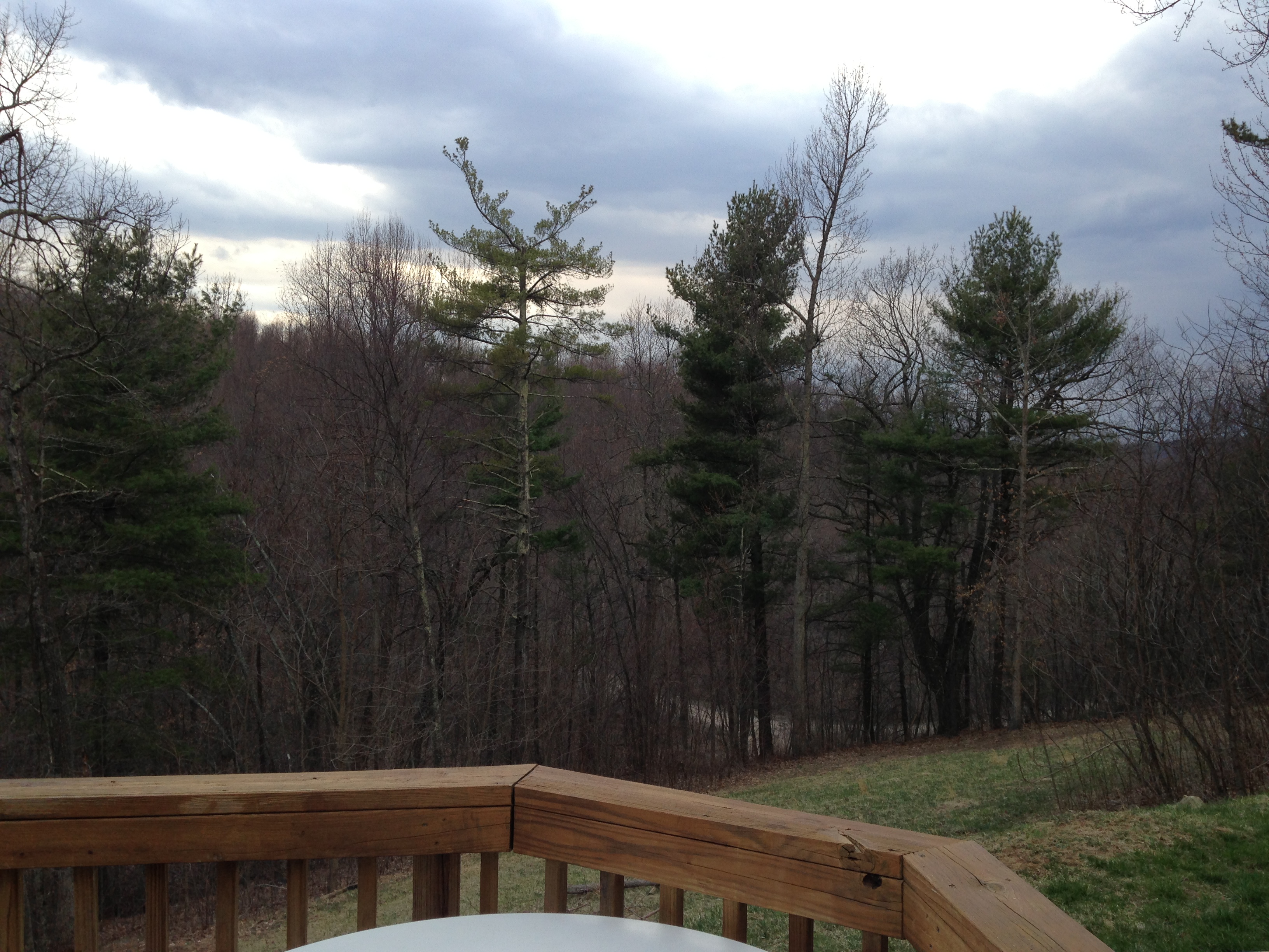
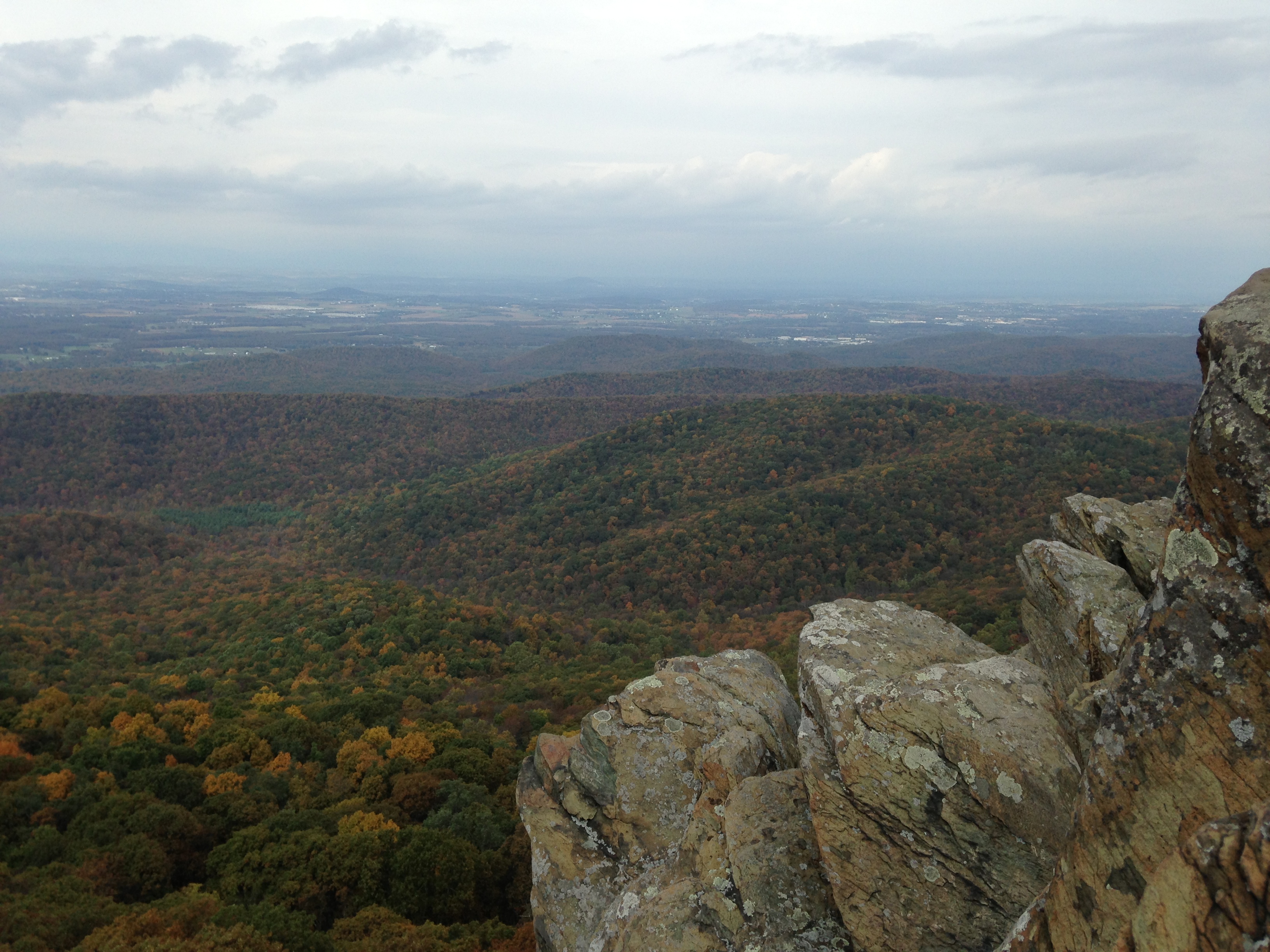
However, after hiking 3-ish miles to the top this Saturday, this is was our view:

IMG_7342

Heavy fog everywhere.  Womp womp.  

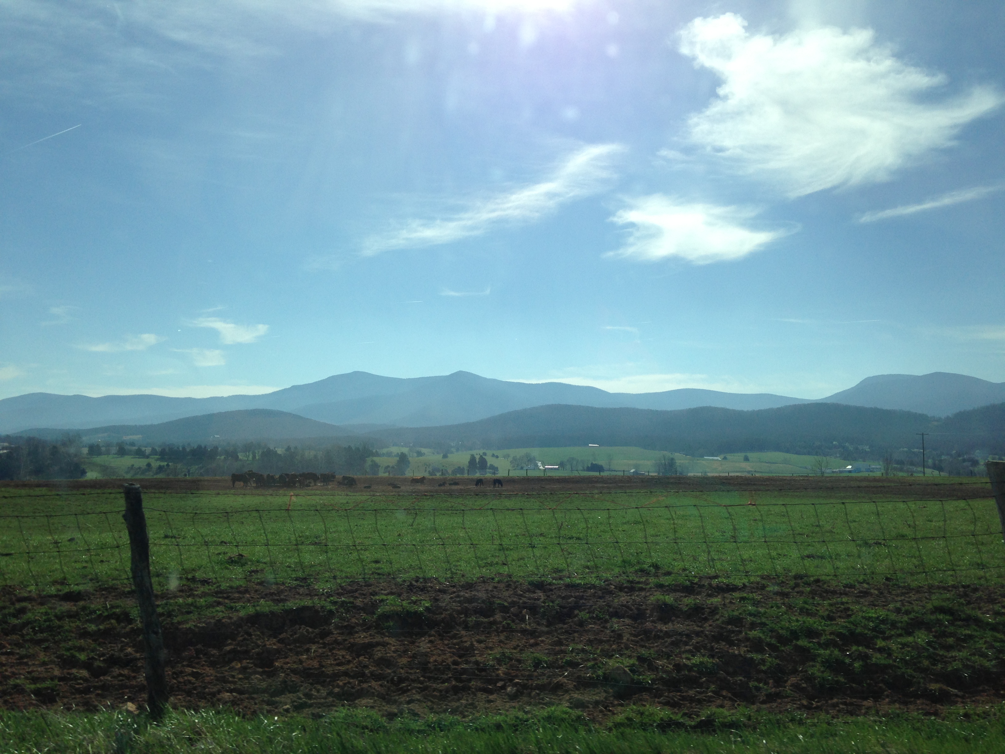
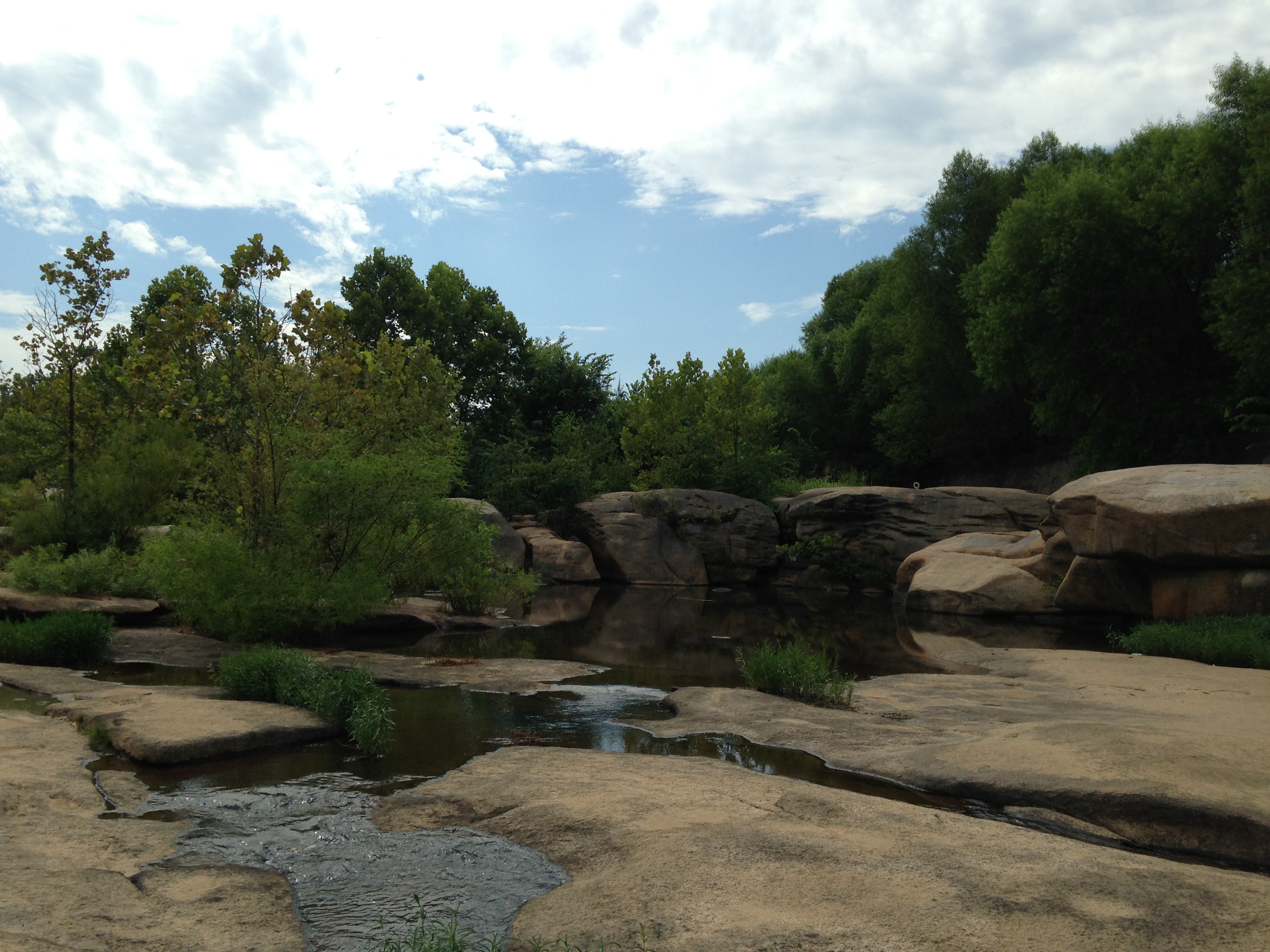
We finished the hike, ate lunch at our campsite, then started our second hike of the day:  Cold Mountain.  This hike is an approximately six-mile loop with nice overlooks on the way to an open meadow with beautiful mountain views all around.  

IMG_7345 IMG_7347  IMG_7368IMG_7350  IMG_7357 IMG_7360 IMG_7354 IMG_7379

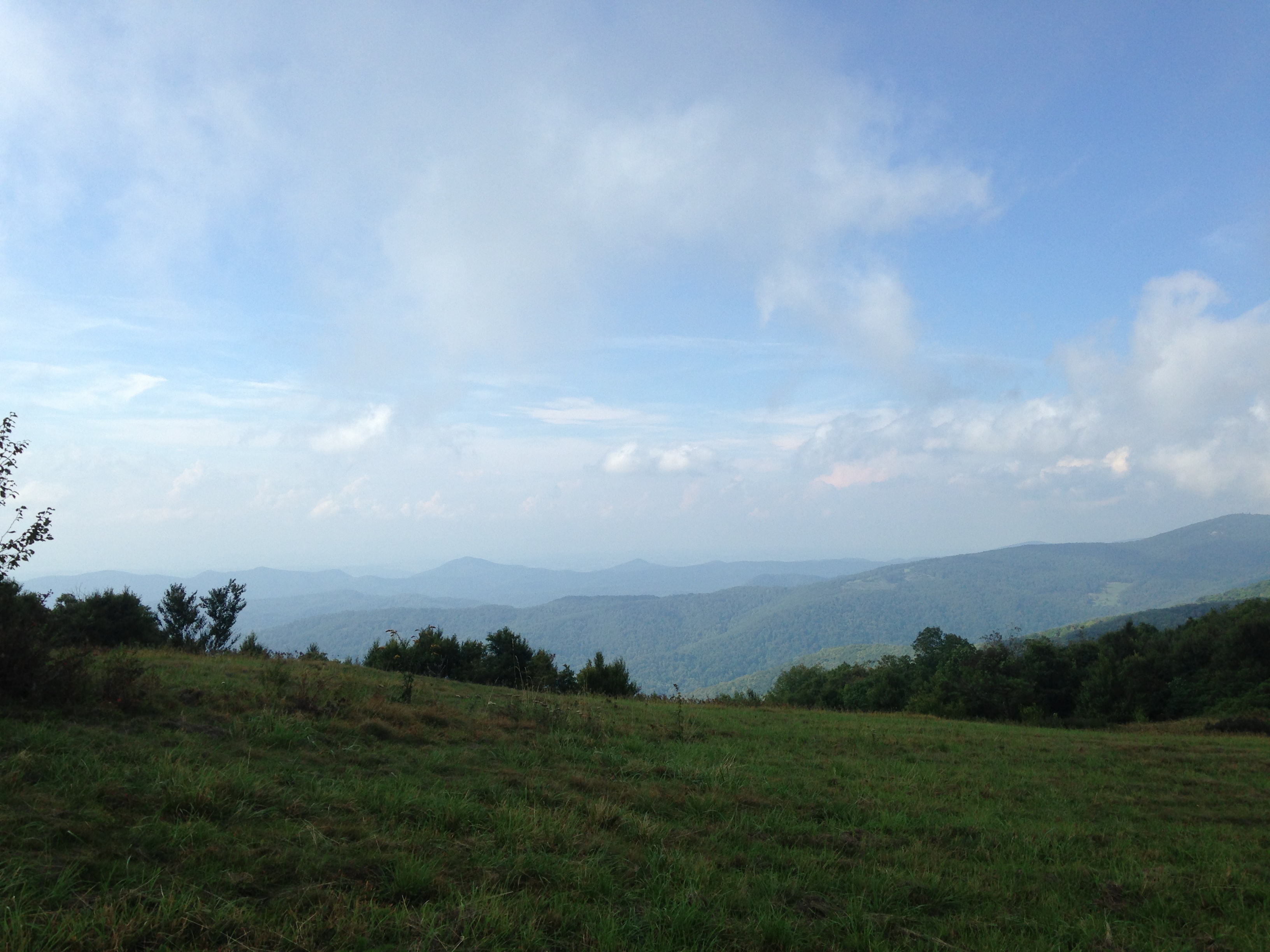
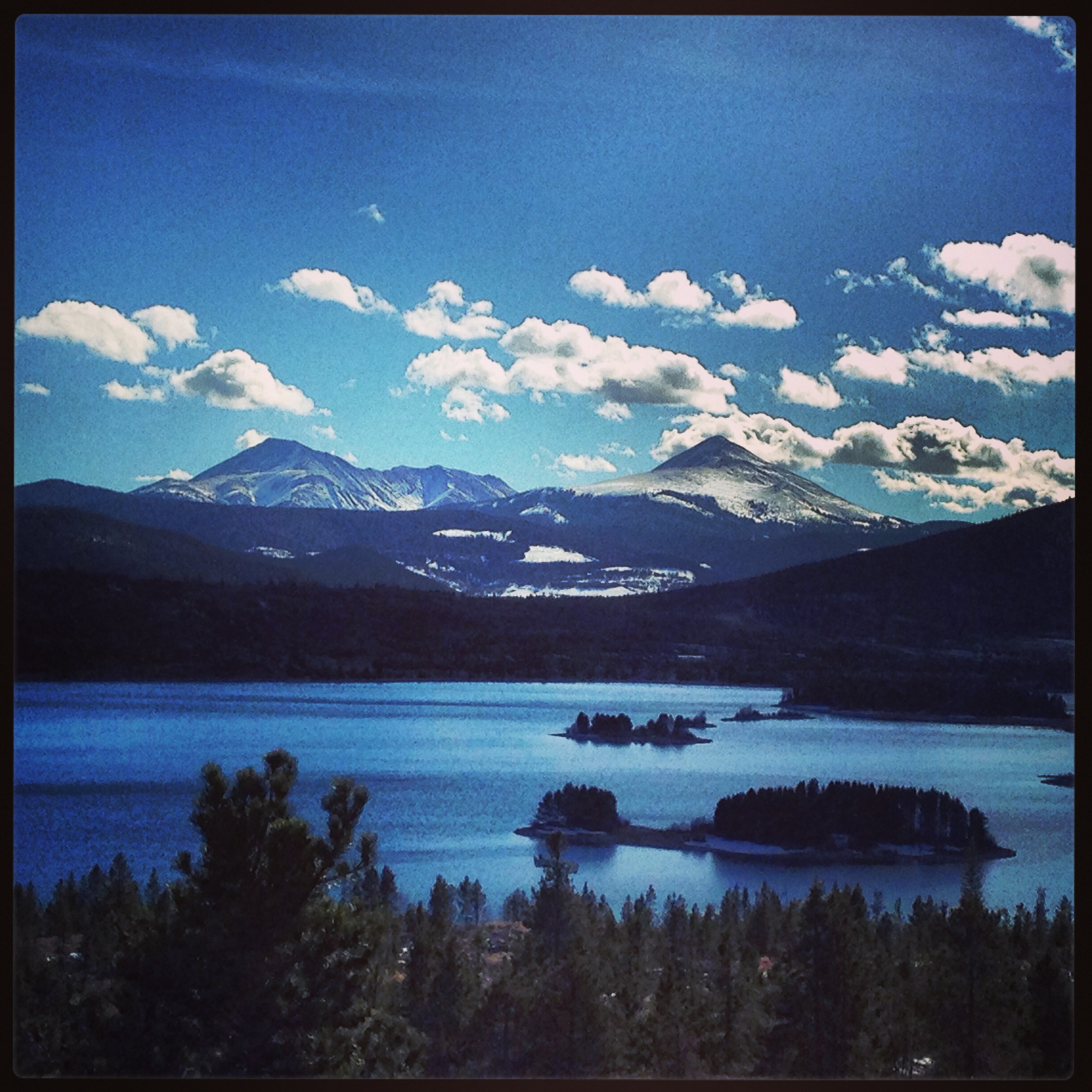
We did encounter some lingering fog, but thankfully we still were able to steal a few glimpses of those beautiful blue mountains that I love.

Back at camp, with achy bodies from 12.5 miles of hiking, we cleaned up as best we could and started cooking dinner.  Just as we put the steaks on the fire, we heard the rain rolling in.  At the threat of not being able to cook the steaks, Andrew sprung into Eagle Scout mode in a way I’ve never seen.  “Tarp!  Someone grab the tarp!  Two tall sticks!  Twine!  Tent stakes!”  Before the rain could touch our fire, Andrew had constructed a shelter for us with a tarp hung over a rope (strung between two tree branches), with two corners held up by large sticks, which were secured to the ground with tent stakes and twine.  Unfortunately I didn’t get a picture because, well, it was pouring rain and very dark at this point, but suffice it to say we were all thoroughly impressed.  We ate our steaks (which were unbelievably delicious after hiking all day) as the fire roared and water rushed under our feet–because, hey, we were still outside in a torrential downpour– and we laughed at how disgusting we all felt covered in sweat and mud, and life was very good.  

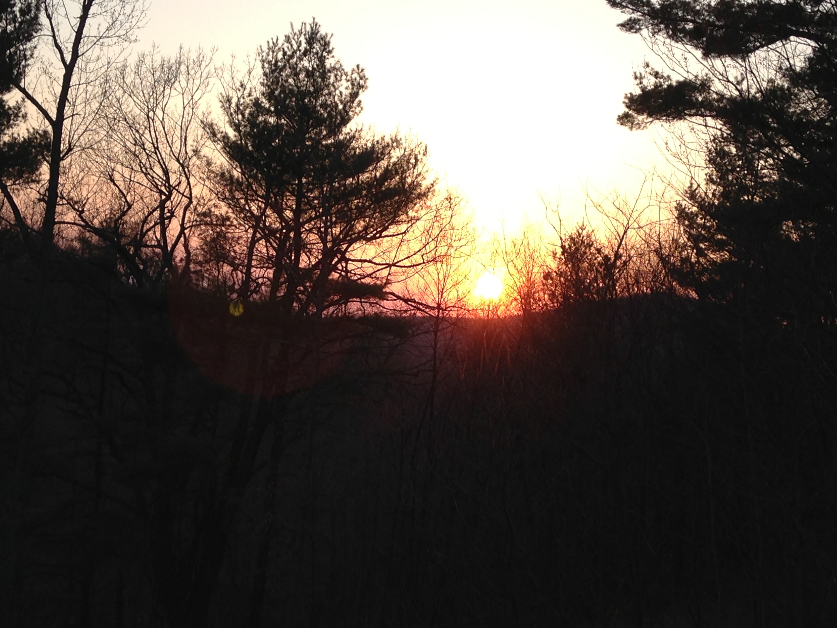
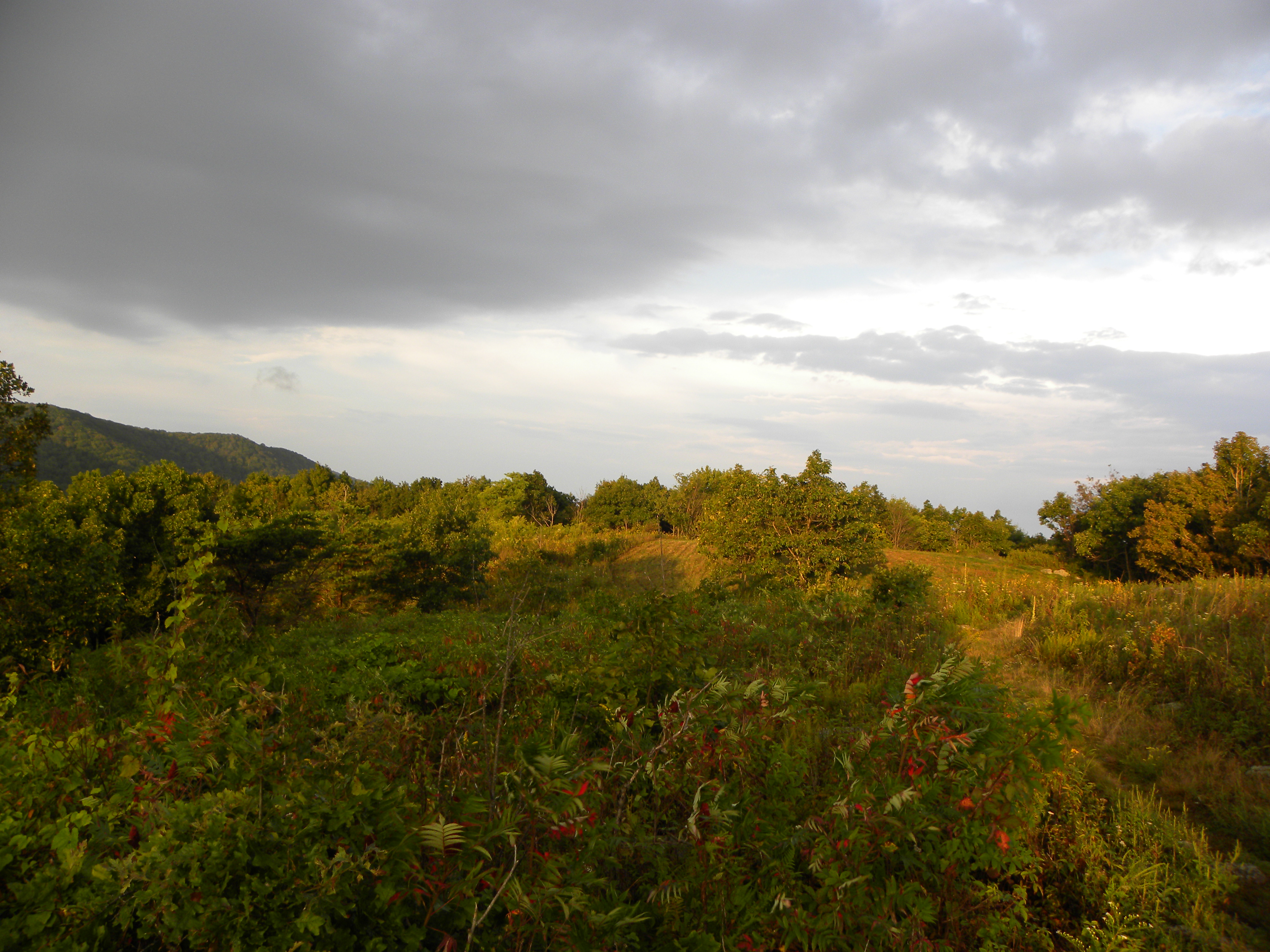
In the morning I woke early and hiked up the Appalachian Trail a bit to catch the sunrise.  


DSCN9367a

It’s no secret that I’m a sucker for a good sunrise–the colors, the stillness of the morning, the promise of a new day.

For me this Labor Day weekend evoked that childhood feeling of being torn between two worlds.  On Friday I wrapped up six years working as a youth minister.  It was a time full of joy and challenges and working with people that I love, but like every season, it had to come to an end to make way for something new.  Today is the start of a new season for me as I pursue a career in personal training.  For the next few months I will be a full-time student preparing for the certification exam, and while I am nervous about venturing into the unknown (and yes, giving up a paycheck for a period), I am thrilled to embark on this journey.

The sun is rising on the first day of a new season for me, and I am giddy about the possibilities of what it may hold.  

Anniversary Weekend Part 2: Caverns, Bird Knob Hike, and Wine-Tasting

Day two of our anniversary weekend in the mountains (you can check out the day one recap here) began with coffee-sipping on the porch of our cabin.

IMG_5092

We could hear a stream rushing somewhere in the woods below and a rooster crowing somewhere in the distance, but there were very few sounds beyond that.  This cabin was the epitome of seclusion, and it was awesome.

IMG_5096

After a leisurely breakfast and a quick dip in the hot tub, we drove into Luray to check out Luray Caverns.  They were pretty cool–it is amazing how it all was formed–but after a while it all kind of looks the same to me.  Andrew, on the other hand, my rock-loving mine engineer, was geeking out the whole time, and that was fun to watch.  There’s basically one rule in the caverns:  don’t touch the rocks (the oil from our skin breaks them down).  We saw one guy in our group sneakily reach out and touch a rock with his finger;  Andrew shook his head, and under his breath said, “Exhibit some self-control, buddy.” 😀

IMG_5110

 IMG_5124 IMG_5101

After our caverning adventure we stopped for lunch at this wonderful restaurant called Gathering Grounds.  It’s a coffee/sandwich shop with delicious food…and gluten-free options!  In a little mountain town like Luray, we weren’t sure how well-versed the restaurants would be in food allergies, but they were incredibly accommodating.  They even had a few GF pastries available for dessert.  Andrew finished his meal with a giant peanut butter cookie and was a very happy camper. 😀  If you find yourself in Luray, check out Gathering Grounds!

We spent a little time exploring Main Street and letting our food digest, then we drove back into the mountains for our second hike of the weekend:  Bird Knob.  Our criteria for choosing this hike were 1. good views (always) and 2. shorter distance… something less strenuous and time consuming than our crazy hike from the day before.  While the Bird Knob hike is 8 miles if you do the entire thing, the overlooks are only 1.5 miles into the hike, so we could make it a 3 miler if needed.

I made certain to pack enough water for this hike, but I didn’t pay much attention to the elevation chart.  My thought process:  “Three miles?  That’s an evening stroll around the neighborhood.”  Wrong, wrong, wrong.  The entirety of the 1.5 miles to the overlook was uphill, and parts of it were annoyingly steep.  It probably wouldn’t have been as difficult if our legs weren’t sore from our hike the previous day.  As we neared the top Andrew said, “Next time I choose the hikes.” 😉

As usual, the views made it all worthwhile:

IMG_5150 IMG_5151 IMG_5137 IMG_5148

We hiked about a mile beyond this, then turned around and made our way back down the mountain.

Back at the cabin we grilled some steaks, poured a couple of drinks, and watched the sun set.

 IMG_5168

IMG_5170 IMG_5171
Gender role reversal: Andrew with a fruity mixed drink, Catherine with a dark stout 😉

IMG_5178 IMG_5180

We concluded our weekend with some wine tasting on Sunday on our drive back to Richmond.  We stopped at Barboursville Vineyards, which is an Italian-owned winery, made to look like an old Tuscan farmhouse.  The wine was pretty good–none of them tasted as much like grape juice as I want wine to taste–but the scenery was beautiful:

IMG_5246 IMG_5204 IMG_5245 IMG_5247

The weekend was simultaneously relaxing and exhausting.  It was so great to get away and be in the mountains, but we (I) picked some tough hikes 😀  Regardless, we were very thankful for the opportunity to celebrate two years of marriage!

-Beach or mountains?  Andrew and I discussed this Saturday; he picked the beach, I picked the mountains (but ask me again when I’m at the beach this summer ;-))
-Have you been to any caverns (Luray or other)?  What did you think?  Are you a rock-toucher/rule-breaker?

Anniversary Weekend Part 1: Hiking Strickler Knob

Today marks two years that Andrew and I have been married!  We celebrated this weekend with a getaway to a cute mountain cabin in Luray, Virginia.  The trip was both awesome and exhausting, filled with hiking and exploring the area.

Friday morning we drove straight from Richmond to the base of our first hike–Strickler Knob–with plans to check into the cabin that evening.  I’d like to give this section of the post a special title based on our (my) experience:

Pack More Water Than You Think You Need

Strickler Knob is about a 9.5-mile hike with an incredible 360 degree view at the top of the mountain.  Now, 9.5 miles is a pretty long hike, and the reviews I read rated it 5 out of 6 in terms of difficulty, but for some reason I was not taking that thing seriously before we started.  I only packed one 24-oz water bottle, and that turned out to be a dangerous mistake.

About ten minutes into the hike, the trail turns very steeply downhill–the kind of downhill that isn’t fun at all–so steep that after .6 mile, when the trail finally started going uphill, it felt relaxing.  During that section all I could think was, “This is going to be terrible on the way back…”  And it was…but more on that soon. 🙂

The entire hike was beautiful;  there was a stream, rock scrambling, and these views at the top:

IMG_5047IMG_5059DSCN9218 IMG_5062   IMG_5048

Amazing.

The return trip is where it became painful.  The temperature was hotter than expected, and with no leaves on the trees yet, there was very little shade.  I’d consumed all of my water, and Andrew refilled my bottle with half of his second bottle (so by being under-prepared, I endangered both of us).  In addition to being dehydrated, rationing water meant that I had only eaten a few bites of my sandwich when we stopped for lunch–with a dry mouth it was tough to swallow.  All around, I did not have enough fuel in my system.

For most of the return trip I felt okay.  We even ran a few downhill sections!  And then we reached the bottom of that d**n hill that I knew was going to be terrible from the start.  Friends, I am in good shape.  Cardiovascularly I can go the distance; the muscles in my legs are strong.  After 8.5 miles, however, with not quite enough water or food, this ascent was not pretty.  I had to stop and rest–and not just rest, but sit down–every .05 miles.  That’s roughly every minute, maybe two on that terrain.  I’ve certainly felt tired on hikes before, but this was the first time I’d ever thought, “I cannot make it to the top of this hill.  How am I going to do this?  I’m going to have to camp here.”  Andrew said he was preparing himself to have to carry me.  It was awful.

And then after a grueling .6 mile, we reached flat ground…and I turned around and cursed the mountainside.

With adequate fuel, it would have been a tough hike, but with only 4.5 cups of water over that distance, it was almost more than I could take.  I was thankful to have Andrew there to encourage me and share his water! Anytime you go into the woods, pack more water than you think you need.

After completing the hike, we made our way to the cabin.

IMG_5084IMG_5086  IMG_5085

Isn’t it cute??  We refueled with dinner cooked on the grill, then relaxed in the hot tub 😀

Despite the dehydration, it was a great day.  I’d like to tackle that hike again with better preparation…the views are worth it!

I will post about the rest of the weekend tomorrow, but for now…

Happy anniversary to the love of my life! 😀

Breckenridge and Hiking Cheeseman Canyon (Colorado Days 2 & 3)

We’ve been home from Colorado for about 32 hours now, and I am thoroughly jet-lagged and exhausted–the good kind of exhausted. The kind of exhausted you feel when you pack a lot of awesome things into a few days. 🙂  Here’s what the next few days of our trip entailed:

Day 2: Breckenridge
On Friday we drove deep into the mountains to the adorable little skiing town, Breckenridge.  These were some of the views as we drove:

 IMG_3227 IMG_3253

It didn’t even look real!  So beautiful.  Once we arrived in Breck, we spent hours walking up and down Main Street exploring the shops…and being the big kids that we are. 😀 

IMG_3239 IMG_3236 IMG_3238 IMG_3241 IMG_3244 IMG_3249

The hat shop was a particularly good time 😀

Day 3: Hiking Cheeseman Canyon

On Friday night, Andrew’s friend and best man Kevin arrived.  Kevin’s sister Julie lives with Jenny, so it worked out well that the five of us could pile into one apartment for a weekend of best friend/family fun. 🙂  Saturday we all went hiking–Andrew later declared it, “Probably my favorite hike ever!”  It was, in fact, a pretty beautiful hike, with the trail following a canyon river. 

 IMG_3274 IMG_3276  IMG_3299 IMG_3292 IMG_3290 IMG_3295 

IMG_3339 IMG_3340

So nice 🙂  One trail ran about 50 feet (?) above the river and had mini trails that led to a lower trail immediately beside the river.  We switched between the two throughout the hike and determined that we covered about six miles total.  While we didn’t gain much elevation overall, the trail was very up-and-down–I could feel it in the calves! 

That night we met up with our friend Ashley for dinner–Ashley is a good friend from Virginia who moved out to Denver about five years ago, and we love that we are able to see her somewhat regularly now!  Unfortunately, I didn’t take any photos. 

I always say (and have written numerous times on this blog) that if I lived within 15 minutes of a mountain I’d hike every day.  After hiking Thursday, walking around Breckenridge Friday (we covered some serious miles), and hiking Saturday, I began to question that declaration.  My legs were achy.  (I don’t know why I made that past tense;  we didn’t slow down Sunday or Monday, and my legs are still achy. :)) 

I will save our last day and a half for another post, but they include Andrew’s birthday and (wait for it…) more hiking. 🙂

Have a great Wednesday!

Hiking in Golden (Colorado Day 1)

Our first day in Colorado was excellent.  After an early morning (4:43 AM) and a long flight (3.5 hours), we finally arrived in Denver; with the two-hour time change, we still had the entire day ahead of us!  Jenny picked us up from the airport, and after dropping our luggage off at her cute apartment, we drove to the town of Golden (home of the Coors brewery, for anyone who’s interested).

We ate lunch at this fantastic sub shop called Snarf’s, then walked to a nearby trail for some hiking.

image image image image

Tree pose… on a tree 😀

Unfortunately, we reached a point where the trail was closed–we ignored the initial sign indicating dangerous conditions ahead, but within 100 feet of our disobedience there was an actual gate closing the trail.  Probably for the best. 🙂

One of the great things about this area is that there are plenty other trails to hike!  We walked back through the small town of Golden and began hiking the South Table.

image image image image image image

As you can see, it was gorgeous!  The last photo was our favorite in a series of jump shots–it looks like we are levitating 😀  The large rock in the first photo of this series is South Table where we hiked to and where the rest of the photos were taken.

We finished the day with some delicious pho, then went to bed shortly after.  By Denver time we’d been up since 2:43 AM, traveled across the country, hiked a bunch, gained an extra two hours in our day–so 9:45 PM (11:45 PM Richmond time) felt like just about the latest I could possibly keep my eyes open.

This morning Jenny is taking us to Breckenridge (or simply “Breck” as the locals call it;  we’ve learned that they love abbreves out here ;-)).

Have a great Friday!

Trail Running + Hiking

For a girl who loves the great outdoors, this has been an excellent week.

I recently started trail-running with a friend Andrew and I met through Ultimate Frisbee, and we met this week for a river run.

IMG_2925 IMG_2917 IMG_2920 IMG_2922

It’s tough to have a bad workout when that’s your scenery!

On Tuesday (my day off), my friend Kate and I drove to the mountains for a hike.  We started with the hike I did a few weeks ago–Humpback Rocks–but when we reached the Appalachian Trail, we walked south rather than north and discovered a few new-to-us overlooks.

IMG_2964 IMG_2966 IMG_2990 IMG_3006 IMG_2951 hiking  IMG_2955 IMG_2953 IMG_3004 IMG_3012  IMG_2998

Gorgeous, right?  We hiked about six miles total, including some serious uphills!  My glutes were a tad sore the next day.

There’s just something about the mountains–and being outside in general–that is good for my soul. No matter how grueling the workout, when there’s beautiful scenery involved, I always walk back inside feeling rejuvenated.

Have a great Sunday!

Did you get outside at all this week or workout in any beautiful places?

Hiking: Humpback Rocks + Dobie Mountain

Hiking is good for my soul.  Apparently it’s good for my heart as well, because we hit the mountains Saturday, and I didn’t have a single heart palpitation all day.  Nature for the win!

Andrew and I went with our friends Evan and Kristina;  Evan is one of my coworkers, and we’d been talking about all going hiking together for a while.  It was great to finally make it happen!  Kristina’s sister and her boyfriend drove up from Virginia Tech and met us at Humpback Rocks.

This hike, which is one of our favorites because of the awesome views and close proximity to home, is always steeper than I remember.  There was very little conversation happening for the first 15 minutes or so :-D.  The ascent to the overlook is only one mile though, so before long we were looking at this:

IMG_2676

 IMG_2672 IMG_2666 IMG_2673 IMG_2668

After we reached this overlook, we decided to continue hiking–the trail meets up with the Appalachian Trail pretty quickly.  Humpback Rocks shares a parking lot with another hike we’ve done recently–Dobie Mountain–and the two are connected by the AT.  Now, we had never done the combined hike and weren’t sure exactly how many miles of AT stretched between the two, but the group decided to give it a try.

This section of the AT (going north) was beautiful–mostly downhill, lots of pretty leaves, and lots of switchbacks.  So many switchbacks… none of which were visible on Google maps (yes, the AT is on there!), so when we’d been hiking for 15 minutes and I said, “We’re just about a mile away from the next overlook,” I was very wrong.  About an hour later, we were…one mile from the overlook.  My bad, guys. 🙂  Eventually we made it, and it was worth the extra miles:

IMG_2684

IMG_2693 IMG_2690

1394317_10101100319233788_1008660897_n

The whole gang

By the time we made it out of the woods, I think we’d hiked about six miles.  Not too shabby!

Hiking just makes me feel alive, and as I previously mentioned, it seemed to quiet the frequent heart palpitations I’ve been having lately.  Plus, we had great company this weekend, which made the day even greater!

Where have you hiked lately?
What was the highlight of your weekend? 

Weekend Backpacking: The Priest and Spy Rock

On Saturday Andrew and I ventured into the mountains for a couple of days of backpacking and camping.  The original plan was to car camp–set up our tent beside the car, which we could then use as a base to store our stuff while we slept or hiked.  At the last minute we decided to make it more of a backpacking trip.  We parked our car in a gravel lot about half a mile from the Appalachian Trail and about 1.5 miles from where we camped, with the intention to still use it as a (less convenient) base, resupplying Sunday so we wouldn’t have to carry everything at once.

When we arrived Saturday afternoon we took what we needed for the night and started the ascent–the very steep ascent.  Here’s a map for reference (I’ve added red dots for your viewing convenience 😉 :

IMG_4358

From the parking area (marked “P”) we hiked to the AT (marked “i”).  From this point on, I will refer to that stretch as, “the half mile of doom”.  It’s a steep, dreadful dirt road that is tough with nothing on your back; add a 20-something-lb pack, and I started questioning my physical fitness levels.  From there we hiked east on the AT to the Priest, which provided little relief in terms of incline, and finally arrived at our campsite (the red dot near the shelter).

We set up camp, met a nice family from very rural Virginia, and made dinner.

IMG_1923 IMG_4355

If we’d had a few more days to plan for backpacking, we would have been more intentional about bringing a lightweight pot/stove and dried food.  We didn’t though, and heavy dinner is the main reason we kept a few things in the car.  Before leaving we’d prepped dinner in a large zip-sealed bag and traveled with it in a cooler–soup with canned chicken, green beans, squash, mushrooms, peppers, cooked rice, black beans, and a bunch of spices.  We put the combination in the pot with water, heated, and enjoyed.  For a somewhat random mixture of canned foods (and a few from our garden), it actually tasted very good!  Who says you can’t eat well in the woods?

We slept–not particularly well, but not horribly either–and I woke around 6:00 AM when the smallest amount of light was coming through the tent walls.  I decided to pull myself out of the sleeping bag and try to catch the sunrise at the overlook less than half a mile away.  (Andrew decided  to keep sleeping :)).  Oh man, it was worth it:

IMG_1934 IMG_1931

IMG_1932

After enjoying God’s awesome creation and the stillness of the morning for a while, I made my way back to camp and waited patiently for Andrew to wake up.  On second thought, “patiently” might not be the right word;  as soon as I heard the faintest stirring sound, I unzipped the tent and demanded that he come outside and play :-D.  We ate breakfast, packed what we didn’t need for the day, and began the 1.5 mile hike back down to the car.

IMG_4353

Coffee and a French press;  it’s all about priorities, people

We dropped off a few items at the car, grabbed our day packs and pre-made lunches from the cooler, and reveled in the lightness of our loads compared to the overnight packs. 😀  Looking at the same map above, we tackled the half mile of doom from the parking lot to the AT, then hiked west to Spy Rock (well, we went a little beyond Spy Rock, but that was the highlight.)

IMG_1959

MmHmm.


IMG_1975 IMG_1967 IMG_1971 IMG_1972

We ate lunch, hiked a bit more, then started walking back.  When we had roughly two miles left until we’d reach the car, it started raining.  Then it started pouring.  In case it’s unclear, two miles is a long way to hike in the rain.  We finally made it back to the parking lot and sat in the car to wait for the rain to stop.  At that point, I was done.  If it was necessary, I could tough out camping in the rain, but my dry bed sounded very appealing at that moment.  Andrew was not as sure, but eventually conceded that the rain was not likely to stop anytime soon and that would not make a great night of camping.

Wouldn’t it be great if we could just start the car and go at that point?  It sure would be… but wait!  Our tent and much of our gear was still at the top of the dang mountain.  So, with 10 miles under our belts and water sloshing in our shoes, we had to make the 1.5 mile hike back up the steep mountain, pack all our gear, and hike back down.  Oy.

We survived but were pretty whipped by the time we arrived home.  Thankfully we had a pre-made dinner in a bag that we just poured in a pot on the stove and heated. 🙂

Even with the rain, it was an awesome trip, and I don’t regret going.  I love those mountain views and the workout they require to view them (our legs were hurting so good the next day!)

How did you spend your long weekend?
Have you hiked Spy Rock or the Priest?

Youth Group Hike (Dobie Mountain Round Two)

What’s better than hiking on a Thursday in perfect 75 degree weather?  When that hike technically counts toward your work week!  (Benefit #2028 of working in youth ministry :-D).  All the youth I work with are currently on summer break, so yesterday a group of us went hiking in the beautiful Blue Ridge Mountains.

Back in May, when Andrew and I hiked Dobie Mountain, I made a mental note that it would be a great hike for a group of youth–nice views, not too long, and not too many steep uphills.  Overall, it was a big hit with the group yesterday, though I did forget just how steep one of the uphills was…

We started on the Albright Loop, which is made up of a lot of woods, rocky trails, and switchbacks.  At one point, as we walked single-file over a small stream, I heard the boy behind me say, “Ouch!”, then the girls behind him, “Ouch!” “Ahh! Ouch!” and so on down the line.  I turned around to see what was happening, and everyone behind me was swatting some insect away from their legs and arms.  I told them to keep walking past the water in case whatever it was had a nest there.  Once we were out of the ouch zone, I inspected the bites/stings.  They looked–and apparently felt–like bee stings, but the victims said the bugs looked like giant mosquitoes.  Anyone know what that is??  One girl’s bite was particularly red and puffy, and when I asked if she was allergic to bees she said, “I don’t know.  I’ve never been stung!”  Oh God, please do not let her have an allergic reaction…  We kept an eye on the wounds, and thankfully no one had any serious reaction!

After about two miles, we reached the intersection of the Appalachian Trail.  When Andrew and I hiked this, we continued south on the AT;  yesterday we decided to hike north for about half a mile to reach an additional overlook.

IMG_1802

IMG_1809

After resting for a few minutes and enjoying the view, we began hiking south–all uphill at this point–to reach the bigger Glass Hollow Overlook and our lunch destination.  I love the sense of awe that everyone inevitably feels when stepping out onto an overlook like this:

IMG_1814

IMG_1820

But seriously–could this be any more beautiful?

We ate lunch and hung out around this area for over an hour.  (Silly me–I thought I would have to convince them to simply be and enjoy the views, but as it turns out, the mountains are hypnotizing to more people than just me.  😉  I kept hearing, “I could stay here all day!”)

IMG_1819 IMG_1821 IMG_1825 IMG_1832

IMG_1817

We still had a few hours before we needed to drive back to Richmond, and the remainder of the hike would only take us about 30 minutes, so we decided to hike a little further on the AT.  We continued for a mile or so, during which I uttered the understatement of the day:  That particular stretch of trail was relatively flat, with soft dirt and lush greenery all around us.  I said, “This is nice little path we’re on!”, and quickly realizing the humor added, “And by ‘nice little path,’ I mean, ‘the Appalachian Trail.'”  Hah!  You know… that nice little path that runs from Maine to Georgia. 😉

IMG_1850

Our fierce, young hikers

IMG_1854

My new friend Juliet who came with us to help and was such a trooper!

We returned to the overlook for one final glimpse, then began the trek back to the parking lot.  This is the part of the hike for which I apparently had slope amnesia.  When we met back up with the Albright Loop, we only had one mile to go, but the first half of that mile was a serious uphill.  How did I not remember that?  After already hiking about six miles at that point, we were hurting!  Eventually we made it and began the trip back to Richmond.

The original plan was to hike 4 miles–the Albright Loop, plus the short trek on the AT to reach the Glass Hollow Overlook.  However, we added a mile to see the first overlook, then about two miles on the AT at the end, bringing our total to roughly seven miles.  Not bad!  When I started hiking yesterday, my legs and glutes were still sore from the cardio class I took Tuesday night.  After all those hills, I am hobbling. 🙂

As always, the hike provided an awesome workout with beautiful scenery to ease the pain.  Plus, I had great company yesterday. 😀

Have you hiked anywhere particularly cool lately?

Buttermilk Trail Hike

Marriage requires many compromises.  Saturday morning, I wanted to drive to the mountains to hike, and Andrew wanted to watch TV for a few hours, then complete some projects around the house (anything to not drive anywhere.)  Our compromise: a quick garden clean-up and harvest, followed by a local hike in the afternoon.

The Buttermilk Trail runs along the James River from the Boulevard Bridge to Belle Isle (I know that probably means nothing to non-Richmonders…sorry), and despite being within the city limits, the hike definitely gives you the I’m-miles-away-from-civilization feeling.  We started on the north bank of the river (by Maymont,) crossed the foot bridge, and headed east.

IMG_1587 IMG_1589

IMG_1592

Soon we were in the woods and letting out our wild sides:

IMG_1605 IMG_1602

IMG_1598

IMG_1610 IMG_1613

IMG_1617 IMG_1620

After about three miles, we arrived at Belle Isle.  Well, we arrived at the large rocks beside Belle Isle;  we had to do some rock-hopping to reach the island.

IMG_1626 IMG_1630

IMG_1632

From there we crossed the river on the pedestrian bridge…

IMG_1637

I ❤ the River City.

…and began walking back on the North Bank Trail.  We enjoyed some pretty nice views of the river, Hollywood Cemetery, and fields of ivy.  We also picked and snacked on a few blackberries. 😀


IMG_1638 IMG_1644 IMG_1666 IMG_1642

While not the mountains, the Buttermilk and North Bank Trails were a surprisingly pleasant local substitute.  They satisfied my desire to be outside in the woods with a serious layer of back sweat.   Hiking is also my favorite active date, and I loved the quality time Andrew and I had while creating the aforementioned back sweat.  😀  According to Hiking Upward, we covered about 6.3 miles.  Not bad!

Have you ever hiked or biked the Buttermilk Trail?
What’s your favorite active date?